 The Grand Forks council reviewed the latest long-range transportation plan from MPO leaders last night (Monday). The system identifies road construction and cost estimates to meet economic…transportation… and sustainability goals 20 plus years into the future.
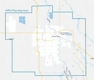
As part of the presentation on traffic movement depicted what would happen if one or two new bridges are built connecting Grand Forks with East Grand Forks. A new south end bridge has been a point of debate between the two cities.
Council President Dana Sande raised the possibility of a bridge location north of Gateway Drive. Sande says it could help alleviate congestion on the downtown river crossings. “I would be interested to know how traffic changes if we built to the north and connected to a newly paved 27th Avenue North that is going to have access to the Interstate.”
An open house to solicit public input on the various priorities of the 2050 plan is set for September 21st.
DRAFT CITY OF GRAND FORKS PRIORITIES
ID Corridor Location (From – To) Project Type
1 S 48th Street DeMers Ave to 11th Ave S Reconstruction
2 S Washington Street 32nd Ave S to 47th Ave S CPR
3 S Columbia Road 17th Ave S to 32nd Ave S CPR
4 32nd Ave S Belmont Rd to Cherry St Reconstruction
5 32nd Ave S Cherry St to S 10th St Reconstruction
6 University Avenue I-29 to N 55th St Reconstruction
7 N Columbia Road U.S. 2 to University Ave CPR and Reconstruction
8 S Columbia Road DeMers Ave to 17th Ave S CPR
9 S Columbia Road 32nd Ave S to 47th Ave S CPR
10 S 48th Street 32nd Ave S to 47th Ave S Pave Gravel Road


FOLLOW US FOR INSTANT UPDATES!


