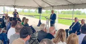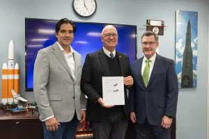
U-S Senator John Hoeven was in Grand Forks this (Tue) afternoon for a first-hand look at the nation’s first drone-based weather forecasting tool.
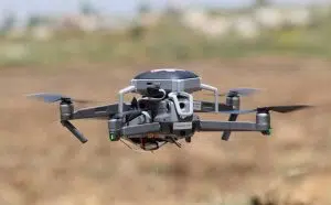
Grand Sky is teaming up on a weather drone that will fly up to 9,000 feet – and possibly up to 16,900 feet — to collect six weather data points, ranging from temperature and barometric pressure…to winds aloft… to help support unmanned operations.
Grand Sky has acquired Meteodrone, an unmanned aircraft operated under a multi-year contract with TruWeather Solutions to collect weather data multiple times a day.
Grand Sky President Tom Swoyer says it will provide another “level of granularity” for specific weather info to support unmanned operations.
The collaborative effort includes the Northern Plains UAS Test Site and the 319th Reconnaissance Wing.
.
(Photo: Sen. Hoeven’s Office)
= =
(Sen. Hoeven release: )
Senator John Hoeven today joined leaders from Grand Sky in announcing the purchase of a new system to facilitate real-time collection of weather data to support unmanned aircraft systems (UAS) flights. Specifically:
- Grand Sky has acquired Meteodrone, an unmanned aircraft that will be operated under a multi-year contract with TruWeather Solutions to collect weather data.
- The aircraft will fly multiple times per day to collect data up to an altitude of 9,000 ft.
- Hoeven is working with the Federal Aviation Administration (FAA), including FAA Acting Administrator Billy Nolen, to secure approval for the Meteodrone to be operated at higher altitudes, up to 16,900 ft.
- The new system will generate very accurate forecasts on a more localized and quicker basis for the Grand Forks region, providing the certainty needed for unmanned aircraft operations conducted by Grand Sky tenants and partners.
- This capability will be the first of its kind for UAS operations in the U.S.
“Grand Forks is equipped to support UAS operations unlike any other region in the world,” said Hoeven. “Unmanned aircraft operators need specific weather data and conditions, where uncertainty means a scrapped flight and added cost. With the Grand Sky Weather Center flying the Meteodrone multiple times each day to collect more accurate and recent information, on top of the enhanced radar systems and BVLOS waivers we secured from the FAA, this region will remain the premiere choice for companies looking to develop, test and implement advanced UAS technologies.”
Today’s announcement builds upon Hoeven’s efforts to expand UAS operations in North Dakota and advance the state’s leadership in this rapidly-growing sector. Earlier this year, Hoeven secured waivers from the FAA for expanded beyond visual line of sight (BVLOS) unmanned flights for the Northern Plains UAS Test Site. This includes waivers to:
- Allow BVLOS flights in the Grand Forks region utilizing enhanced radar software.
- The software upgrades improve the safety and security of BVLOS flights, but required a new waiver from the FAA before being deployed.
- Support UAS flights involving aircraft that do not have a public designation, which means:
- Companies can fly with the test site to get the experience necessary to prove that their aircraft are safe in preparation for accessing the wider National Airspace System (NAS).
- A larger number of companies will be in position to obtain BVLOS waivers through the test site in the future.
New BVLOS waivers face a lengthy approval process, and Hoeven worked to accelerate these approvals based on North Dakota’s strong track record of safe UAS operations.


