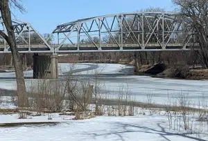
As snow totals go up — so does the threat of spring flooding in the Red River Valley. The National Weather Service and River Forecast Center today (Thursday) updated the 2023 Spring Flood Outlook.
The latest analysis says the risk of moderate or higher flooding has increased and is now above long-term historical averages for most reporting points. Above normal snowfall through the winter – and the continuation of below normal temps – has increased the flood chances.
KNOX Staff Meteorologist Mark Ewens says weather patterns in the coming weeks and month will have an impact. “The current forecast takes into account normal precipitation and normal snowmelt patterns. If we were to get a very heavy snowfall…or perhaps ill-timed rains…then we would look at values that bump crests higher.”
The 50-50 crest for flooding in Grand Forks / East Grand Forks is now 44.4 feet – or nearly two feet higher than two weeks ago.
.Red River Long-Range Probabilistic Outlook by River Stage…
Valid from March 27, 2023 to June 25, 2023
LOCATION 95% 90% 75% 50% 25% 10% 05%
——– —— —— —— —— —— —— ——
Red River of the North…..
WAHPETON 11.9 12.1 13.1 14.3 15.3 16.4 16.8
HICKSON 27.5 28.1 30.4 32.6 34.0 35.4 36.3
FARGO 29.5 30.7 32.7 34.2 36.4 37.8 38.6
HALSTAD 32.5 33.7 35.7 38.2 39.5 39.9 40.2
GRAND FORKS 41.0 1.8 42.9 44.4 46.5 49.2 50.0
OSLO 35.0 35.3 35.7 36.3 37.3 38.4 38.7
DRAYTON 38.6 39.5 40.1 40.8 41.8 42.9 43.5
PEMBINA 45.6 46.8 47.7 49.6 50.9 52.3 52.8


FOLLOW US FOR INSTANT UPDATES!


